
Enid ZIP Codes in Postal Use
The official Oklahoma ZIP code table identifies five codes in Enid's postal geography: 73701, 73702, 73703, 73705, and 73706. It does not publish a neighborhood-by-ZIP map, separate station assignment for every code, or a definitive city-limit classification. The Enid ZIP code directory therefore keeps the known facts and the unresolved boundary questions side by side. For any deliverable address, use USPS verification instead of assigning a code from a map impression or a nearby street.
| ZIP code | Official Enid-area coverage | Post office evidence | Verification note |
|---|---|---|---|
| 73701 | Enid postal area; exact neighborhood split is not stated | Enid Post Office, 115 W Broadway Ave, Floor 1, Enid, OK 73701-9998 | Verify a specific address with USPS ZIP Code Lookup. |
| 73702 | Enid-area ZIP in the Oklahoma table; exact delivery area is not stated | Separate post-office assignment not located in the official sources | Do not infer a neighborhood or city-limit status from this code alone. |
| 73703 | Enid-area ZIP in the Oklahoma table; exact delivery area is not stated | Separate post-office assignment not located in the official sources | A dated health table provides a population figure, not a boundary definition. |
| 73705 | Enid-area ZIP in the Oklahoma table; exact delivery area is not stated | Separate post-office assignment not located in the official sources | A dated health table provides a population figure, not a postal classification. |
| 73706 | Enid-area ZIP in the Oklahoma table; exact delivery area is not stated | Separate post-office assignment not located in the official sources | Use USPS address lookup rather than a presumed local boundary. |
Postal geography can include city, rural, and post-office service patterns that do not match municipal lines. Keep the full address, verification date, and source output with the ZIP code rather than treating the code as a resident, parcel, or jurisdiction label.
Check an Enid ZIP With USPS
USPS ZIP Code Lookup is the documented official route for confirming a specific delivery address. Start with the number, directional, street type, unit, city, and state. Save the returned postal format and the date checked. The result can supply a ZIP or ZIP+4 for mail delivery, but it does not establish a parcel's legal description, municipal location, ownership, or the date a historical household occupied the address.
The official USPS listing for the Enid Post Office documents the local 73701 location used for postal-verification context.
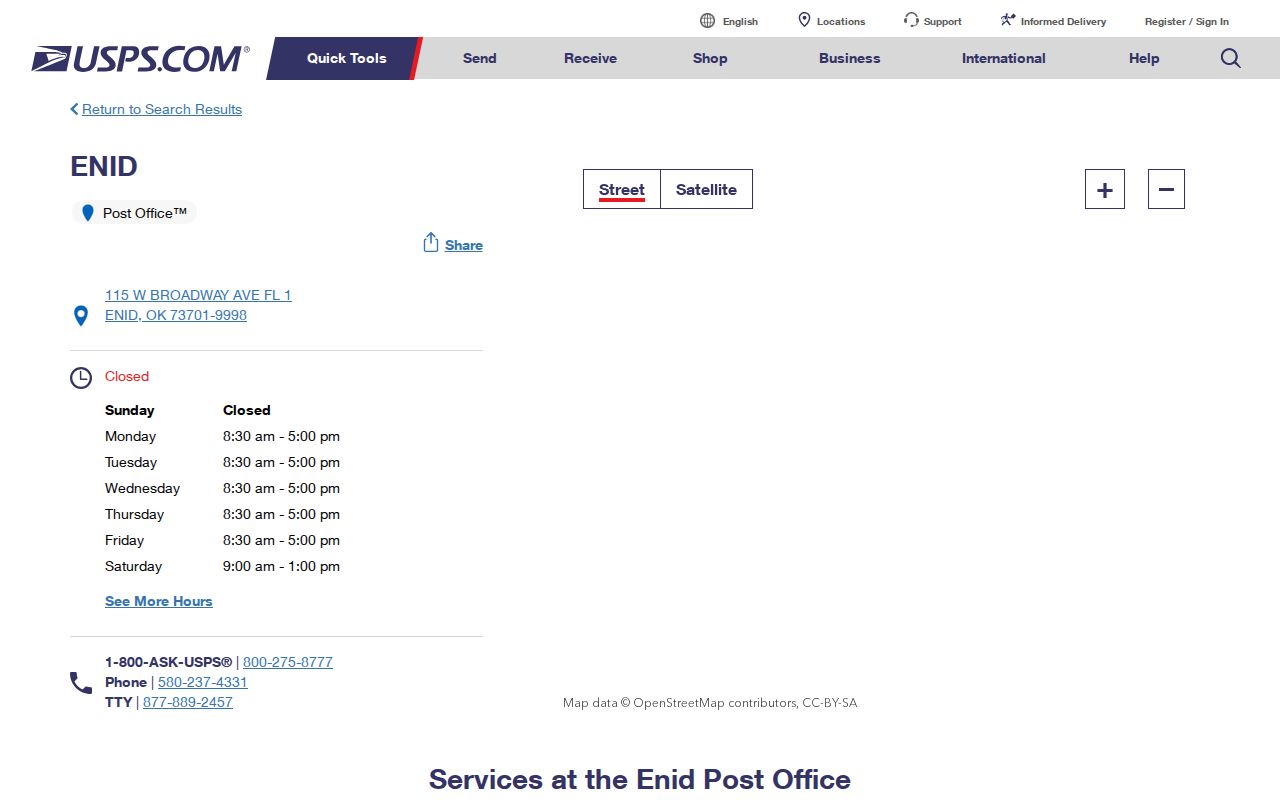
The postal location confirms an official Enid contact point, while USPS address lookup supplies the address-specific check. The research did not establish a distinct station or delivery boundary for each of the other Enid-area ZIP codes.
- ZIP code
- A five-digit postal routing code for a delivery area. It is not a city-boundary or parcel-ownership field.
- ZIP+4
- An added four digits that refine delivery routing for a complete address. Preserve it when USPS returns it.
- PO box ZIP
- A code used for post-office box delivery. No Enid-area PO box classification was established in the official research, so do not assign one here.
- Carrier route
- A postal delivery grouping. No Enid carrier-route map was located in the inspected official sources.
Numbers Behind Enid ZIP Codes
An official Oklahoma health population-density table adds limited, dated context to three local codes. It lists 25,313 for 73701, 29,722 for 73703, and 344 for 73705 for that table's reporting period. The same table did not show rows for 73702 or 73706. These figures are useful only as a snapshot of the state table, not as a count of people at a current address, a city population measure, or proof that a ZIP sits inside the Enid city limits.
Read the official population-density-by-ZIP table with the postal table, not in place of it. Missing rows should not be converted into claims that a code has no delivery use or no residents.
Note: ZIP statistics describe a reporting area at a stated time and do not replace address-level USPS confirmation.
Enid ZIP Code Directory Search Limits
Official sources did not document a ZIP-wide Enid resident or parcel search. The Assessor landing page does not expose a ZIP control before its dynamic handoff. The ArcGIS parcel service is spatial and query based, but its visible metadata does not state a ZIP filter. The Oklahoma Voter Portal verifies an individual and returns election-service information, not a public ZIP-wide list. The Election Data Warehouse form includes the requester's ZIP as contact information, not a record filter.
- Verify the complete address through USPS, including ZIP+4 when returned, and save the delivery format.
- Use the exact address in the assessor or GIS route for parcel context. Do not claim that either official source supports a ZIP filter unless its live screen confirms one.
- Use Enid city maps to check municipal context, such as wards, quadrants, floodplain, or street closures. Those layers are not postal-boundary maps.
- For one named person, use the Oklahoma Voter Portal only for its lawful individual verification functions, which require the registered name and date of birth.
- After an address is narrowed, move to the Enid street directory for the parcel, deed, permit, and historical-address trail.
| Official service | Documented ZIP role | What it cannot establish |
|---|---|---|
| USPS ZIP Code Lookup | Address-specific delivery ZIP and postal format | City boundary, legal description, ownership, or occupancy. |
| Garfield Assessor landing | No ZIP control documented before dynamic QPublic handoff | A confirmed ZIP-wide property query from the inspected screen. |
| Enid GIS parcel service | Spatial parcel query and map functions | A published postal ZIP layer or ZIP-wide resident result. |
| Oklahoma Voter Portal | Individual verification and election-service functions | A public street or ZIP-sliced resident roster. |
| Election Data Warehouse | Controlled voter-list request route with eligibility attestations | A casual ZIP filter or a substitute for the official process. |
Parcel Addresses and Enid ZIP Codes
County deed and assessor systems are parcel and legal-description systems. A ZIP may appear as a mailing or display detail, and it can change without changing the parcel's legal identity. Keep the addition, block, lot, township or range, recording date, and instrument number exactly as the county record gives them. Then use the street address as a crosswalk, not as a replacement for the legal description.
The City of Enid's parcel service can supply mapped geometry, query, identify, and export context. The Assessor landing warns that tax-roll data can change, and the live QPublic fields were not captured in research. A situs address is the physical property address when displayed. A mailing address can differ, so it should not be silently merged with the situs address or ZIP.
Note: For a parcel question, record the owner-of-record date separately from the postal-verification date and from any dated household source.
Enid ZIP Codes Beyond City Limits
Postal delivery geography and a municipal boundary answer different questions. Enid's official maps provide quadrant, ward, floodplain, street-closure, truck-route, trail, and bike-map context. They do not provide ZIP polygons. The city profile in Census QuickFacts reports municipal statistics, while USPS determines address deliverability and postal formatting. Neither source should be used as a shortcut for the other.
Use the Enid city maps to understand the city layer and Census QuickFacts for Enid for dated municipal context. The official research did not locate an Enid ZIP-to-neighborhood table, a ZIP-capable GIS layer, an accessible local ZIP polygon map, or a documented ZIP realignment year. The Enid ZIP code directory preserves those gaps instead of drawing boundaries that have not been published by an official source.
Boundary check. Confirm delivery with USPS, municipal location with the city map or GIS, and parcel identity with the legal description. A single ZIP code cannot answer all three.
Older Enid Addresses and ZIP Codes
ZIP codes are modern postal information, so they are not a dependable key for older Enid household research. Preserve the historic street wording, place label, and date shown in the original record. Enid directories did not list buildings by street address until 1923, according to Oklahoma Historical Society material. Earlier research may need a name or business section, lot and plat description, newspaper item, and Sanborn map rather than a current delivery code.
Historic records may use Enid, Enid Station, North Enid, or another postal or county place label that does not map cleanly to the modern city. Pair a historical address with a directory, newspaper, map, or Clerk plat. That approach explains a location without inventing a ZIP conversion that the source never supplied.
Enid's record history makes those place labels especially important. County history traces the area through the 1893 Cherokee Outlet opening, while North Enid history describes the earlier Enid Station and the later county-seat dispute. A record from the 1890s may reflect a new town, a railroad conflict, or a postal convention rather than a stable modern grid. Preserve the original place name beside the modern research note. It can be the key to finding the right directory, newspaper issue, plat, or courthouse record.
Requesting Enid ZIP Records
A ZIP alone is too broad for a focused public-record request. Give the city or county office the exact street address, parcel or legal description if known, street segment, date range, and the existing document requested. For city material, identify whether the request concerns a permit, ordinance, resolution, easement, map, or CivicWeb item. For county material, include the addition, block, lot, or book and page. The office can then identify an existing record without being asked to make a custom geographic list.
Use the Enid open-record request form for city-held documents that are not already available through public search. The Oklahoma Open Records Act route provides reasonable access to existing records, but it does not require an agency to create a new ZIP-based report. Keep any USPS result with the request so the postal form and date are clear.