
Trace an Enid Street Address
A street search works best as a short chain, not as one claim about everyone on a block. The tax roll and parcel map establish a property reference. The deed index records a title event. A dated directory, census entry, permit report, or public civic document can offer a separate address clue. Those records have different dates and purposes, so label each result as owner, occupant clue, mailing address, or parcel context. The sequence below keeps the legal description attached to the address rather than allowing a matching street name to do all the work.
- Normalize the full Enid address, preserving its direction, street type, unit, and the spelling shown on the source.
- Open the Garfield County Assessor parcel landing, accept its tax-roll notice, and compare the live parcel display with the official GIS map.
- Record the parcel ID and legal description, then look for the same addition, block, lot, or township wording in the Clerk index.
- Search the deed index by the legal description, date, instrument type, and grantor or grantee. Save the record number, book, page, and recording date before seeking a copy.
- For an earlier household clue, ask the Enid Public Library or Cherokee Strip Regional Heritage Center about by-address directory, newspaper, map, or photograph leads.
A deed establishes a recorded instrument or title event. It does not, by itself, prove that the named owner occupied the address on the same date. Pair it with a dated source when the question concerns a person rather than a parcel.
Enid Street Directory Search Fields
The Garfield County Assessor parcel landing identifies the office at 114 W Broadway, Room 106, and says its data comes from the last certified tax roll. Its acceptance control opens a dynamic QPublic application. The inspected live target returned a 402 response, so no owner, address, parcel, value, exemption, or sketch field should be assumed from that landing page. Use the visible disclaimer as a reminder to check the date and then verify any parcel detail through the office or a second official record.
The official QPublic landing shown below is the street directory's starting screen, not evidence of a particular parcel or person.
After accepting the notice, compare the live card only with the Clerk index and the GIS service. The research did not capture the QPublic field labels, which is why this Enid street directory does not promise an address or ZIP filter.
| Control or field | What is documented | How to use it carefully |
|---|---|---|
| Assessor data acceptance | Required before the dynamic handoff | Read the last-certified-tax-roll and change disclaimer first. |
| Owner name and situs address | Expected in a live parcel tool, not captured | Confirm current labels and do not infer a display format. |
| Parcel number and legal description | Expected result fields, not sampled | Cross-check with the Clerk and GIS before relying on either. |
| GIS Identify or Query | Supported by the City parcel service | Use the returned map feature as parcel context, not title proof. |
Map an Enid Street Parcel
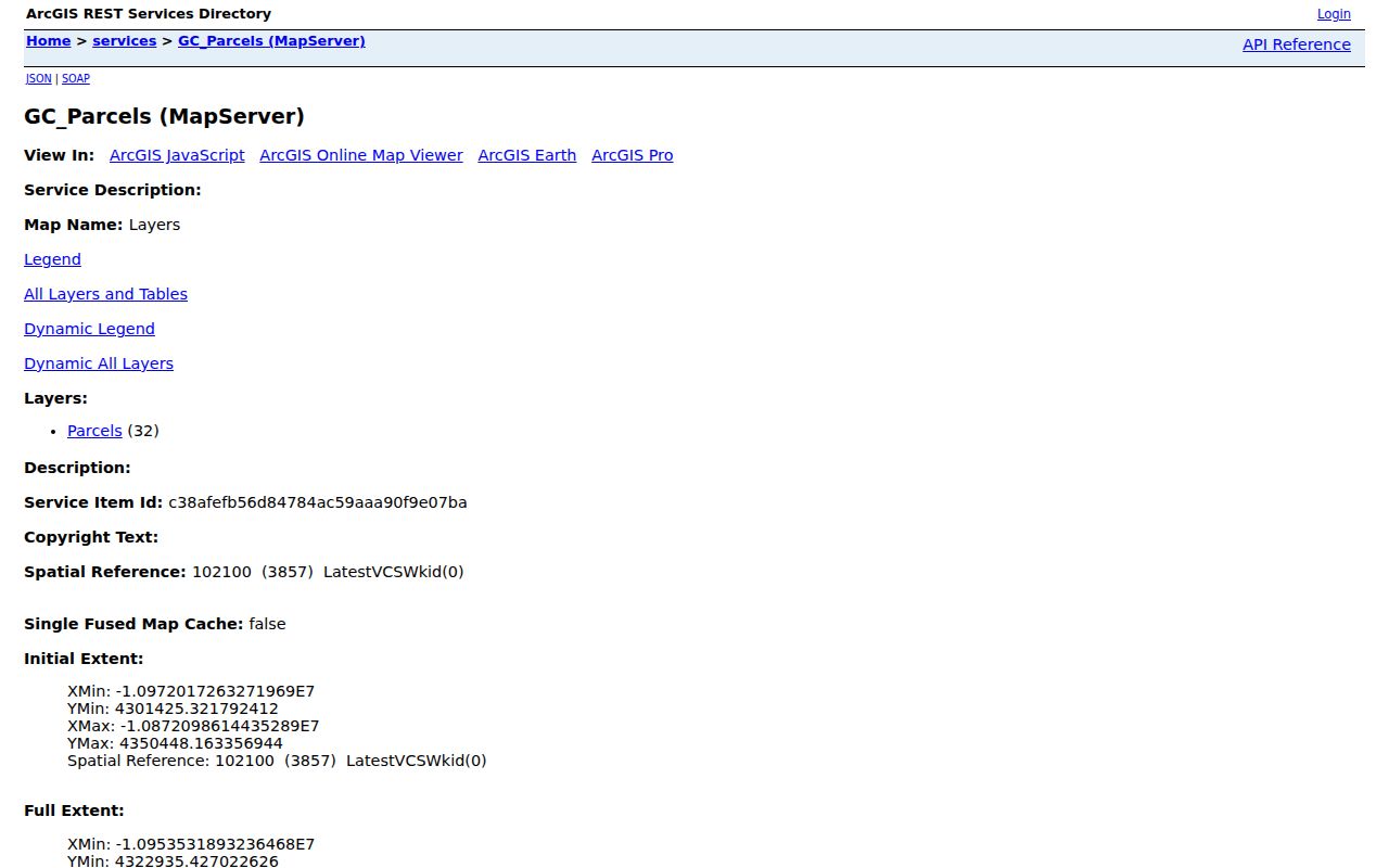
The City of Enid's parcel MapServer is public ArcGIS infrastructure rather than a roster of residents. Its metadata documents Identify, Query, Find, Export Map, Generate KML, and query formats including JSON, GeoJSON, and PBF. It also reports a maximum record count of 1,000 and a maximum selection of 2,000. Those limits describe service behavior, not the number of properties on a street. Use a returned parcel geometry and map point to connect an address to the legal-description work in the county records.
The official Enid parcel service captures the GIS functions available for street-level parcel context.
Separate GIS overlays from ownership evidence. The city's zoning and floodplain services can explain planning or flood context, but neither layer establishes who owns or occupies a street address.
- Parcel
- A mapped unit of land used for tax and GIS reference. It may have a street address, but the legal description remains important.
- Situs address
- The physical property address, when a record displays one. It can differ from an owner's mailing address.
- Plat
- A recorded map that lays out additions, blocks, lots, streets, or easements. It can bridge an old addition description to a current address.
- Criss-cross directory
- A directory arranged by address rather than name. No exact Enid run was located, so ask local repositories about by-address sections instead of assuming one exists.
Note: The interactive city viewer was not readable in the research capture, so verify its live identify panel before treating it as a fielded address search.
Follow Enid Street Deed Entries
The Garfield County legal index is the practical online route for a parcel's recorded title trail. Its structured search offers Addition, Township, Block, From Date, To Date, and Instrument Type. Legal Name/Bk&Pg provides the grantor, grantee, and book-page route, while View All Legal broadens the index view. Results show Rec#, Grantor, Grantee, Date, Ins Type, Book, and Page, with sortable headings, a filter box, and a page-range or PDF action when available.
The county page says online records are saved from 2003. For an earlier Enid street address, contact the County Clerk, who is ex officio Register of Deeds, about older books, grantor-grantee indexes, and the in-house database described as reaching back to 1988 in an official OCC booklet. The Clerk's counter and copy route is the documented fallback. A clerk-made copy costs $1 per page and a clerk-certified copy costs $2 per page under the current fee schedule.
Keep addition, block, lot, township or range, book and page, instrument number, and recording date together. A modern street address is a useful crosswalk, not a substitute for the legal description.
Note: When the online index stops, ask about a specific legal description and recording period rather than assuming every earlier deed was digitized.
Enid Street Permits and Actions
Enid Community Development handles public-side streets, alleys, easements, and utilities, as well as private-side building and land-use work. Its page links processes for construction, demolition, inspections, zoning, lot splits, rezoning, and certified-owner notices. Monthly building-permit reports were visible for 2021 through 2024 and for January through July 2026. They can provide address, project, and date leads, but request the underlying record when a report leaves out a detail needed for a careful conclusion.
For street changes, the City Clerk's public categories include deeds and easements, ordinances, resolutions, contracts, legal notices, and minutes. Search CivicWeb with a street name plus terms such as resolution, dedication, vacation, right of way, alley, plat, annexation, permit, or renumber. A city request should name the department, street segment or intersection, date range, and existing document type. It should not ask the city to create a fresh list of people tied to a street.
Note: A permit, notice, or easement can place an address in a dated municipal record, but it does not establish every person connected with that address.
Read Older Enid Street Addresses
Older street work requires a different approach. Oklahoma Historical Society material reports that Enid directories did not list buildings by street address until 1923. Before that point, look for a person or business in the name and business sections, then pair the result with lot and plat records, newspapers, or Sanborn maps. The Enid Public Library, Cherokee Strip Regional Heritage Center, and Oklahoma Historical Society hold directory or local-history leads; the precise Enid reverse-directory run was not located in the official research.
The 1925 Enid Sanborn map can show street labels, building footprints, stories, materials, use, and sometimes house numbers. Official history sources document local maps as early as 1894, with editions or maps from 1894, 1895, 1896, 1898, 1901, 1904, 1908, 1911, 1917, 1925, and 1930. Inspect the image and confirm its edition before using a number or building outline as evidence.
Newspapers are another bridge when an address changed form. Search the relevant date range around a move, construction, legal notice, or death, then inspect the scanned page rather than relying only on OCR text.
Enid Street Directory Record Layers
Each address-keyed record set answers a limited question. The table keeps the layers distinct so an owner-of-record, planning overlay, city action, and historical address clue do not collapse into one unsupported conclusion. The Enid street directory is strongest when a later record confirms the place and an independent, dated source confirms the person or household connection.
| Address record | Local keeper | Street-level use | Access and limit |
|---|---|---|---|
| Assessor parcel and tax roll | Garfield County Assessor | Parcel and owner-address context | Dynamic parcel route after disclaimer; last certified tax roll stated. |
| GIS parcels | City of Enid GIS | Geometry, map point, query, identify, and adjacent-parcel context | Public ArcGIS service; historic layer dates not stated. |
| Recorded deeds and liens | Garfield County Clerk | Grantor, grantee, instrument, date, book, page, and legal description | Online saved records from 2003; older books require Clerk confirmation. |
| Plats and additions | County Clerk and city planning records | Block, lot, addition, and street-layout crosswalk | Exact online plat catalog was not located. |
| Permit reports and city actions | Community Development, City Clerk, and CivicWeb | Address, project, public action, or document lead | Reports and searchable minutes exist; seek an underlying record when needed. |
| Historical directories and maps | Library, CSRHC, OHS, and map collections | Dated address-to-occupant and building-context clues | Street listings begin in the documented 1923 directory era; map evidence is not occupant proof. |
For current address work, keep the assessor, GIS, and deed date beside every note. For historical work, pair the directory year with a map, newspaper, census, or plat. That creates a record trail that can be checked rather than a list built from mismatched periods.
Note: Oklahoma voter tools verify an individual using registered name and date of birth; the inspected portal did not provide a public street-wide resident list.
Enid Additions Along the Street Grid
Historic additions are useful date and place anchors for an Enid street search. Kenwood was platted on April 16, 1894. Waverley First was platted on May 15, 1902, followed by Waverley additions in 1905, 1906, and 1907. A district name in an old record may therefore be more useful than a modern street-number guess. Start with the addition, block, and lot from the source, then test it against the plat and the official boundary description.
The Kenwood and Waverley guideline supplies historic context, and the Enid municipal code identifies the block-and-lot-specific historic-district boundaries. Neither source should be used to assign a resident to a neighborhood without first matching the legal description.
The 1907 county courthouse was destroyed by fire on January 29, 1931, and the present courthouse opened in 1934. Those dates are useful when a record trail shifts between older books, courthouse references, and later access routes.
Limits of an Enid Street Directory
An address search does not produce a complete household list. A parcel owner is not necessarily the occupant, a mailing address is not necessarily the property address, and a directory or census result is tied to its own date. Oklahoma's voter information has restricted fields and protected classes, and the inspected voter portal verifies an individual rather than returning a street-wide result. The research also found no official live Garfield County jail roster and no exact Enid reverse-directory run to treat as a current roster.
Respect restricted voter records and Address Confidentiality Program protections. Full or partial driver-license and Social Security numbers are not public voter fields. Utility customer and delivery-recipient details were not established as public Enid street records. When a record cannot answer the question, use the appropriate official office or leave the conclusion open.
Lawful use. Enid street and property records support personal, lawful research. Do not use an address trail to stalk, harass, intimidate, or harm any person.
Requesting Enid Street Records
When the online route is incomplete, a focused request produces a better response. For county records, provide the addition, block, lot, section, township or range if known, book and page or instrument number, and an approximate recording period. For city records, identify the street segment, department, date range, and existing document sought. The Enid open-record form allows a requester to describe records and choose review or copy delivery, while the clerk, planning office, library, and heritage center each handle different material.
Use the Enid open-record request form for city-held documents that are not already in CivicWeb or a permit report. For an older address, ask the library or heritage center for by-address directory, newspaper, Sanborn, and photograph leads, supplying both old and modern street wording where known. The County Clerk's office is at 114 W Broadway, Room 105, Enid, with filings accepted until 4:00 p.m.; call ahead when a certified copy or older book is needed.